Administrative Boundary Changes and the Emerging Challenges and Risks in the Information Technology Sector
New Map, New Rules: Vietnam’s Transport Industry Transforms Ahead of the Administrative “Earthquake”
July 1, 2025 marks a historic milestone for Vietnam’s administrative map, as the number of provinces and cities is streamlined from 63 to 34. This change is not just on paper but represents a powerful “earthquake,” especially for businesses in the transport and delivery sector.
Renaming, code changes, and boundary adjustments for thousands of communes, wards, and towns are posing a major challenge: - How can the massive IT systems in the logistics industry adapt promptly, avoid service disruptions, and ensure a seamless customer experience?
Let’s join TrackAsia in a deep-dive analysis of the challenges, potential risks, and strategic solutions to help businesses confidently weather this “storm” of change.
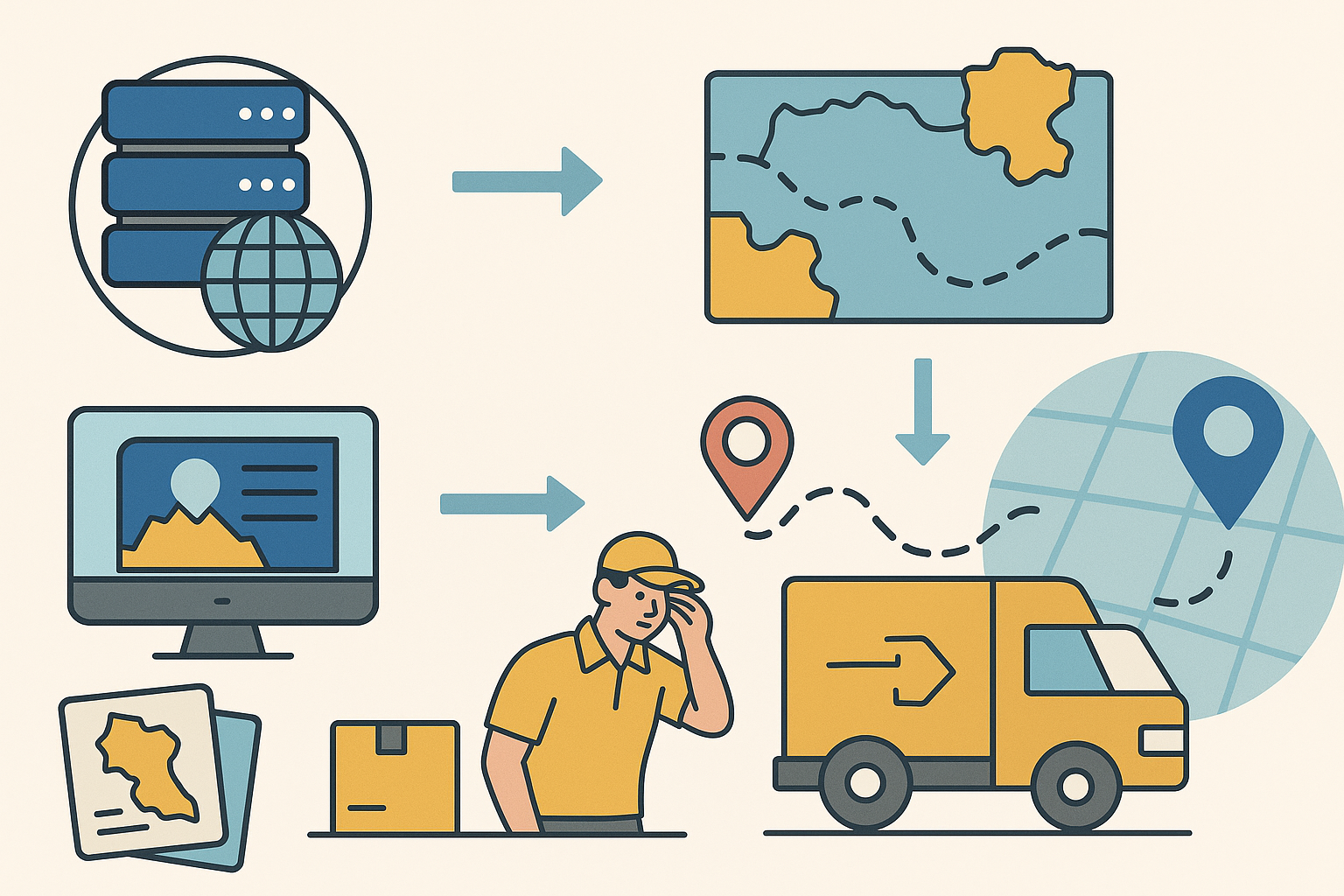
Integrating administrative boundary updates into IT systems: Government agencies publish new data and maps. For example, in Hanoi, cadastral maps for 126 communes and wards have been updated to accurately reflect the new boundaries. Enterprise IT systems can integrate this data through map APIs and administrative databases.
Internal GIS systems also need updates: digital maps, geolocation data, region code tables, and place names. Update steps include: collecting the new administrative listings, standardizing address names, linking old and new administrative codes, and re-entering data into CRM, ERP, TMS, WMS, etc. Synchronization across all platforms is mandatory to avoid data inconsistencies. During the initial roll‑out, many cadastral maps are incomplete or inconsistent, and new commune/ward boundaries may be unclear. This makes it difficult for businesses to correctly identify addresses, segment delivery zones, or process location data.
- Example: A location name may be recorded differently across sources, especially in areas undergoing mergers or splits. Some areas lack clear boundary maps, complicating system processing. Therefore, tech companies must proactively review, cross‑reference multiple sources, and update flexibly — even using user feedback to ensure map accuracy reflects local reality.
Without input data standardization, businesses are prone to conversion errors. Using automation tools (APIs or middleware) helps ensure no orders get lost due to incorrect place names.
- Furthermore, boundary changes also create challenges for many user groups. Many residents still remember and use old addresses, causing entry and lookup confusion for deliveries or administrative procedures. While younger users can quickly adapt via web or mobile apps, older adults or children may struggle to distinguish between new and old addresses, increasing the risk of service errors.
Challenges for Transport and Delivery Businesses
Changes to delivery zones and shipping rates: Administrative boundary changes require recalculation of delivery fee formulas. Without updates, systems may miscalculate shipping charges.
Disrupted delivery routing: Automated routing systems must adapt to new data flows. Using outdated maps may lead to incorrect directions and suboptimal routing.
Mapping apps and APIs: Many businesses rely on third‑party maps. If partners haven’t updated their data, search results may be inaccurate.
Confusion between old and new addresses: Inconsistent address entry by users and staff can lead to delivery failures or lost orders.
Data entry discrepancies: If input addresses aren’t standardized, mismatched data affects search, routing, transactions, and reporting.
Need for software synchronization: All software systems—online (web/app) and offline (POS, warehouse systems, etc.)—must update address data, user profiles, customer databases, and delivery addresses. Missing any platform may cause operational errors or processing issues.
Economic Impact and Competitive Factors
Delays and errors in the update process not only frustrate customers but also directly affect a company’s profitability and competitive position.
Rising operating costs: Routing mistakes lead to longer distances, higher fuel consumption, and increased labor costs. Handling misaddressed or returned orders manually consumes additional time and resources.
Branding and communication costs: Changes to ward, district, or province names may force businesses to redesign signage, banners, promotional videos, printed materials, and ongoing campaigns. This incurs extra design‑print‑production costs and time to revise materials across all offline and digital channels.
- Although Official Letter 4370/BTC-DNTN 2025 and Article 63 of Decree 01/2021/NĐ‑CP state that businesses aren’t required to update their registered license if only the administrative unit name changes, in practice, updates are still needed for signage, transaction documents, and invoice or contract templates. These hidden changes, if unplanned, lead to significant unanticipated costs.
Revenue decline: Customers losing trust may switch to competitors if service is unstable. Canceled or delayed orders directly reduce revenue.
Brand reputation damage: In a fiercely competitive market, even a few major incidents can severely damage a company’s reputation, making it harder to attract and retain customers.
Competitive advantage: Businesses leading in data updating and standardization gain a strong edge by optimizing operations and delivering superior customer experiences.
Data and system update costs: To synchronize new addresses, companies must invest time and staff to audit, edit, and update data across all systems. This process also requires cross-checking, testing, and ensuring consistency, especially in organizations with many departments and interlinked processes. Without supporting tools, costs can skyrocket and disrupt operations. Using standardized administrative data from partners like TrackAsia helps shorten deployment time, reduce errors, and optimize technical costs.
Potential Risks and Customer Impact
Data incidents: Mismatched address data can delay deliveries, generate incorrect locality on invoices, and complicate lookup and complaint resolution.
Operational errors: Systems not updated in time can confuse staff. Auto‑classification and routing software may malfunction.
Service disruption: Users may encounter errors when placing orders or need to cancel or adjust manually due to unrecognized addresses.
Supply chain impact: Incorrect addresses in contracts, invoices, or licenses may cause legal disputes or delay registrations.
Outdated delivery apps: Many apps still display old administrative addresses, causing driver errors, cancellations, or delays.
Postal and conversion tools: Online old–to–new address conversion tools help improve flexibility and reduce mistakes.
Data standardization: Using a standardized address dataset ensures systems function accurately despite boundary changes.
Real business example: Advn Global is currently located at 472 Tran Hung Dao, Ward 2, District 5, Ho Chi Minh City. After administrative boundary changes, the new address becomes 472 Tran Hung Dao, Cho Quan Ward, Ho Chi Minh City. If not updated promptly in identification systems, orders sent to the old address may be returned or misdelivered.
Strategic Approaches
Standardize and update data: Audit and normalize addresses across systems. Update new administrative codes and use address verification tools.
Store old–new addresses in parallel: Allow systems to accept both formats to ensure operational continuity and reduce confusion.
Automation and API integration: Integrate map APIs and boundary databases for automatic updates.
Use artificial intelligence: Employ AI to process complex addresses, normalize and match data, and support lookups.
Maintain boundary history: Record changes over time to ensure accuracy and easy retrieval of historical data.
Industry-wide standardization and data collaboration: Share datasets with partners, government, and map platforms. Promote postal code standardization.
Staff training: Train operations teams on boundary changes, address verification, and data checking before creating orders.
Conclusion: - Administrative boundary changes pose a significant challenge to the transport and delivery sector. Without thorough preparation, IT systems can fail, causing service disruptions and diminishing customer experience. To succeed, businesses must prepare early, test thoroughly, update data comprehensively, and collaborate closely with stakeholders.
TrackAsia Maps, with its rapid administrative data update capability, is a reliable solution in this context.
Ứng dụng cung cấp kịch bản sẵn có, dễ dàng tích hợp vào hệ thống, tối ưu quản lý và trực quan hóa dữ liệu, hỗ trợ nhà phát triển xây dựng giải pháp nhanh chóng.
Working together on new ideas
Ý tưởng của bạn
tạo ra tác động
Việc đưa ngành công nghiệp này tiến lên không chỉ cần kỹ năng,
tài năng và chuyên môn, mà còn cần trí tưởng tượng. Từ tất cả chúng ta.
Tối ưu chi phí cho doanh nghiệp
Chúng tôi cung cấp dữ liệu đó dưới dạng thông tin có thể hành động được.
Tăng khả năng hiển thị và kiểm soát
Chúng tôi cung cấp dữ liệu đó dưới dạng thông tin có thể hành động được.
Tối ưu chi phí cho doanh nghiệp
Chúng tôi cung cấp dữ liệu đó dưới dạng thông tin có thể hành động được.
Tối ưu chi phí cho doanh nghiệp
Chúng tôi cung cấp dữ liệu đó dưới dạng thông tin có thể hành động được.