When Google Maps began updating its data in line with Vietnam’s administrative mergers, many assumed it was simply a change in “naming.” But from a technical perspective, this is a direct collision with the core data layer. When the data foundation is shaken, every operational structure built on top begins to fall out of sync.
Let’s join TrackAsia in diving deeper into the real-world “frictions” that systems are facing, to understand that maps are not just visual displays—they are a matter of data survival.
The first issue lies in Geocoding. Users still input addresses based on old habits: old districts, old wards, outdated administrative names. Meanwhile, mapping systems prioritize updated data.
Consequence: The API returns ZERO_RESULTS or completely incorrect coordinates.
Backend pain point: The parser cannot match, database mappings become inconsistent, causing the entire downstream processing flow to fail in a chain reaction.
Across tech forums recently, it’s not hard to find “laugh-or-cry” stories from real users. Let’s hear how data is directly testing their patience:
"With just one click to locate from a ward in Hanoi, the system suddenly takes me all the way to Noi Bai Airport in an instant," one user shared about an unbelievable data mismatch.
Even more dramatic are cases where a home address is still in Vietnam, but the map insists the user is near an international border. Or the story of diners in mountainous regions: trusting a constantly jumping map pin turns a simple trip to a familiar restaurant into an endless wandering journey through renamed streets.
From an observer’s perspective, these are not random “location errors.” They are signs of a system losing direction—a machine trying to interpret input using an outdated language. When foundational data no longer “understands” where users want to go, every navigation effort afterward becomes meaningless.

In delivery operations, administrative boundaries are not just for display—they are operational logic. When Google renames districts, merges wards, or redraws boundaries:
Algorithm mismatch: Zone routing becomes incorrect, orders are sent to the wrong hubs, drivers head in the wrong direction.
When a “500m deviation” becomes a cost-burning problem for businesses:
In the world of logistics, administrative boundaries are not merely names on a map—they are the backbone of operational logic. When foundational data goes out of sync, the consequences go beyond the screen—they directly cut into business revenue.
Let’s hear a frustrated voice from a food business owner:
"Every order now feels like a chase. The address on the app is one thing, but in reality it’s off by hundreds of meters. Drivers keep circling, and our phones keep ringing with customers asking for directions..." — A restaurant owner in Ho Chi Minh City
From a management perspective, this is a massive invisible cost gap. Consider a simple calculation: A system processing 1,000 orders per day. If each order is delayed by just 10 minutes due to incorrect positioning or invalid addresses, the business wastes over 160 operational hours daily.
This is no longer a “display issue” or a minor inconvenience. Those 160 hours translate directly into labor costs, fuel costs, reduced efficiency, and most importantly, erosion of customer trust. In the race for fast delivery, a 500m deviation on the map can be the line between profit and loss.
Most backend systems today process addresses using a strict hierarchical structure: Province → District → Ward. When administrative changes occur, this structure immediately breaks: districts may be removed or upgraded, wards may be merged and completely renamed.
Consequence: The address parser assigns incorrect fields or cannot process the input at all.
When data becomes a “mismatched hybrid”: In real operations, it’s not uncommon to see addresses like: "Xa Duc Lap Ha, Huyen HCM, Long An Province".
More importantly, sometimes errors don’t come from missing data—but from excessive input habits. Consider this real example from administrative paperwork:
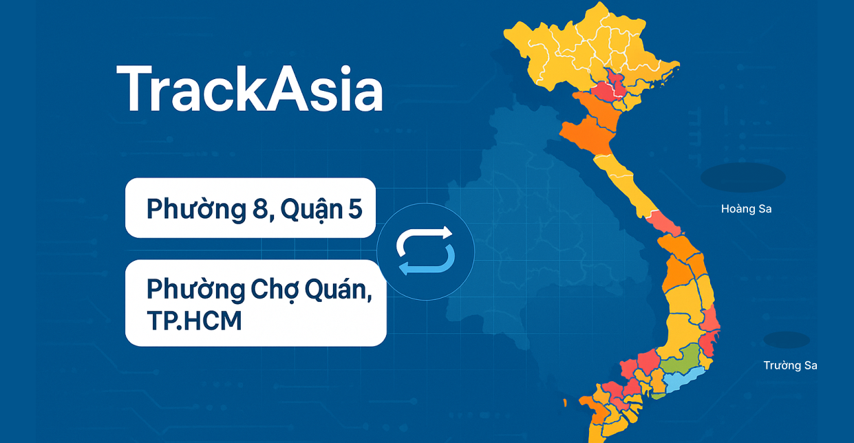
Old address: 129F/... Nguyen Huu Hao, Ward 6, District 4, Ho Chi Minh City.
New standard address: 129F/... Nguyen Huu Hao, Khanh Hoi Ward, Ho Chi Minh City. (Due to administrative restructuring and ward merging).
Out of habit, the user writes: 129F/... Nguyen Huu Hao, Khanh Hoi Ward, District 4, Ho Chi Minh City.
Result? Immediate validation failure.
From a parser’s perspective, “District 4” becomes heavy noise. The system falls into a logical deadlock: “If it is Khanh Hoi Ward, then District 4 does not exist (new system). But if District 4 exists, then the ward should be Ward 6 (old system).”
This is a data normalization disaster. For users, it feels like being careful. For backend systems, it is meaningless data due to hierarchical conflicts. When the parser cannot correctly extract information, all downstream automation—from delivery fee calculation to routing—collapses. A system that cannot understand user language and filter redundant data will never produce accurate results.
When address data is no longer accurate, users don’t care whether the issue comes from Google Maps or your system. For them, there is only one conclusion: the app doesn’t work.
Consequence: User experience is disrupted. Address search becomes difficult, positioning becomes unstable, and results are no longer reliable.
Chain reaction: Customer patience is extremely limited. Even a small positioning error can cause users to abandon the platform and switch immediately.
Experience barrier: When users have to do more than usual to complete a simple task like searching for an address, the experience is already broken. Every wrong location erodes trust.
Real examples:
Let’s hear from actual users:
These are not just technical issues—they indicate the system no longer “understands” user intent.
In the race for user experience, once users no longer trust what they see on the screen, they will look for another system that feels more reliable.
For long-standing systems with millions of customer addresses, administrative changes turn historical data into a burden. All accumulated data runs on an outdated dictionary.
Consequence: Reports become inaccurate. Changes in district or regional names cause incorrect filtering, KPI calculations, and market growth analysis. The same geographic area gets recorded as multiple entities.
Backend pain point: Data from Google Maps API no longer aligns with internal databases. Some addresses follow the old structure, others follow the new one, making it impossible to determine whether they refer to the same area. All logic dependent on administrative boundaries—routing, reporting, analysis—begins to drift out of sync.
Real example:
Consider how a business dashboard can be “misled” by its own data.
Previously, all orders in an area were recorded under District A. After administrative updates, the same area is split: part remains in District A, part is recorded as District B.
On reports:
But in reality, nothing changed—only the data was split.
Strategic risk:
Businesses make decisions based on dashboards:
But if input data is wrong, every decision that follows is also wrong.
When the data foundation is misaligned, all management metrics become illusions—and the cost is expensive business decisions.
Google Maps operates on a global data system and never fully synchronizes with administrative timelines in each country like Vietnam.
Consequence: Map data always has latency or changes unpredictably. Backend systems cannot determine a single “source of truth” to follow.
Backend pain point: Sometimes Google updates too quickly, causing API results to change suddenly while internal databases still use old structures. Other times, real-world data has changed but Google hasn’t updated yet, creating a mismatch with actual operations.
Backend systems fall into a dilemma:
No option is truly safe.
Real example:
A system updates all address data to match new administrative structures aligned with Google Maps. Shortly after, Google changes display logic again, altering API results.
Result:
Core issue:
This is no longer just a technical problem—it is about data control.
When systems depend entirely on third-party platforms, any external change can disrupt the entire internal system.
Backend teams are no longer proactive—they are merely adapting to a data source they do not control.
What is happening is not simply a map issue—it is a problem of platform dependency and lack of internal data control.
Maps are not just for visualization—they are the backbone of operations. For users, it’s a few wrong locations. For businesses, it’s cost, experience, and system stability.
The core issue lies in data control.
Global map platforms rely on multiple data sources, but cannot always reflect local administrative changes in a timely manner—especially in cases like Vietnam’s administrative mergers.
Meanwhile, another approach is gaining attention:
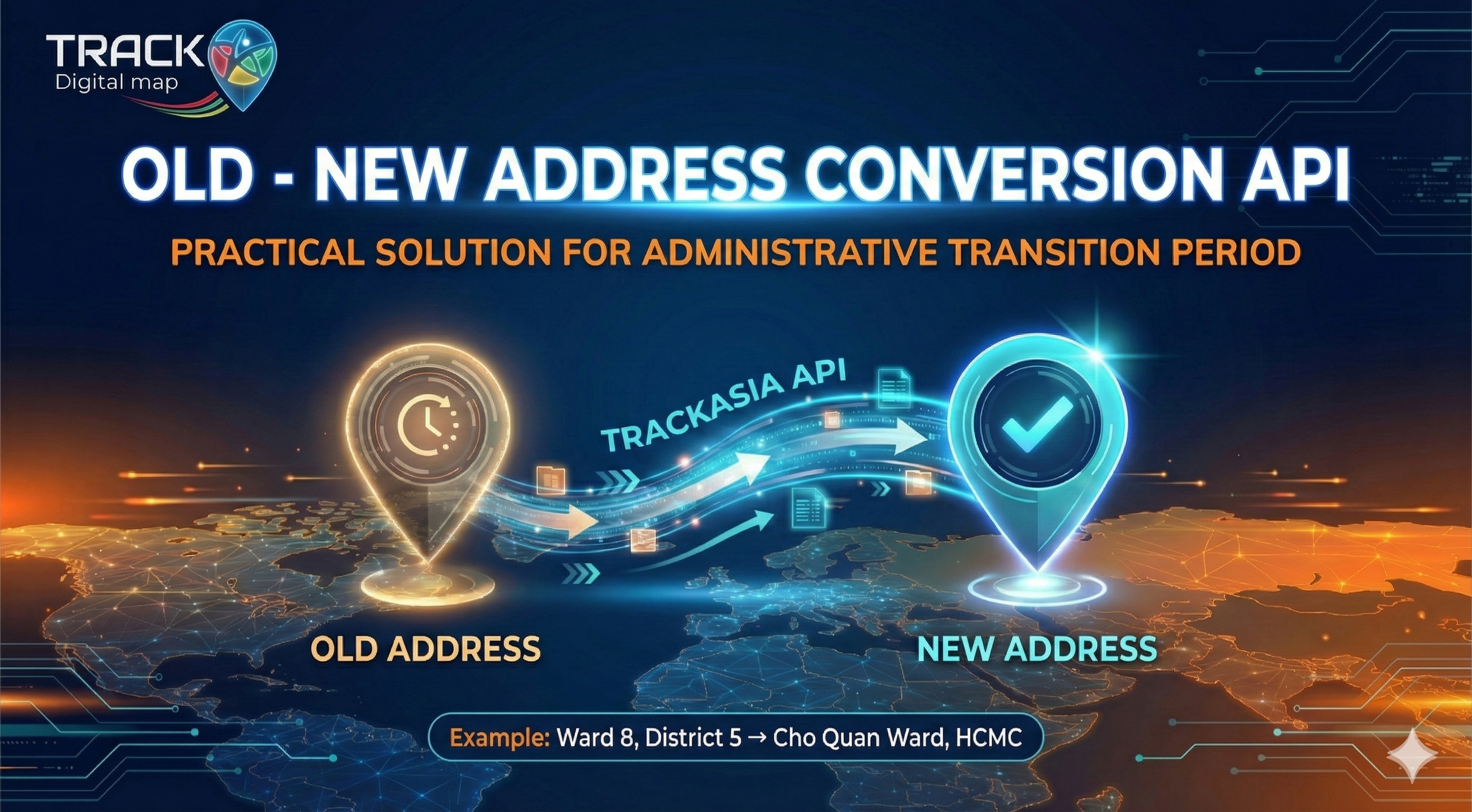
Platforms like TrackAsia are following this direction—where data is not just collected, but verified and controlled within local context. This allows businesses not only to “use maps,” but to truly own the data behind them.
TrackAsia – From a Vietnamese map vision to real operational data
 English